Louping Around the Lammermuirs
May 2008
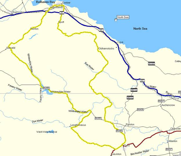
I had been looking for a decent bike ride to do during the lighter months for a while ¢ something a bit more testing than just a straightforward there and back again kind of thing, but not quite in the Tour de France category. I was given a copy of ōCycle Tours Around Edinburgh and the Scottish Bordersö by Nick Cotton a year or two ago which looked like it might offer some possibilities. The rides in that are generally about 30 miles long and reasonably leisurely ¢ however there are a couple rated strenuous, which can be combined using a few additional roads to give an almost 60 mile round trip ride from Dunbar to Duns and back again across the Lammermuirs.
ItÆs quite a few years since IÆve explored that particular part of the world in any detail, but I recalled some fairly steep hills from driving around there.Those memories were reinforced by looking at the OS map, there are some fairly interesting features ¢ in particular some bits with single and double chevrons on the roads ¢ a single chevron is between 1 in 5 and 1 in 7 ¢ and a double chevron is 1 in 5 or less! That sounded challenging enough for my purposes.
I mentioned my plan to Sandy ¢ Mr super fit ultimate keen cyclist ¢ who kindly volunteered to drive us down to Dunbar and back ¢ and Pete, who after humming and hawing for a moment also agreed to come along.
The date was fixed and we prayed to the weather gods ¢ at one point it was looking a bit iffy as bands of rain were coming in from the west, but for once the strong Easterly breeze that had been blowing for the last few weeks worked in our favour, holding the rain off. As the day arrived it was a bit grey and overcast, but the sun was starting to break through as we left Edinburgh.
We got our excuses in on the way down to Dunbar ¢ Sandy recovering from a bad bout of sciatica, Pete with his super heavy steel framed bike and a few extra years on Sandy and myself and me having had knee surgery earlier in the year, not to mention being considerably bigger and heavier than them!
The Route
We set off from Dunbar station with a fairly stiff breeze behind us, although it quickly switched to more of a south easterly as we got away from the coast. Looking at the map you can see that that translates into a headwind for much of the first half of the ride. We crossed the A1 and headed up the B6370 towards Garvald. Pete and I had covered a small section of this in the opposite direction between Garvald and Stenton a couple of years ago on our trip to Berwick, which was also the first serious outing for my road bike ¢ itÆs not quite as shiny now as it was then ¢ but it has done over 5000 miles in that time. The road started to climb gently, with quite a few undulations, until we got to Garvald where we turned left and headed into the hills proper ¢ at this point it started to go up ¢ seriously up.
I had to stop for a breather having tried to
climb the first seriously steep hill around the 10 mile mark just a bit too fast.
I got to the top of the steepest part with a
serious oxygen debt. At least this time around I had a 26 on the
back as compared to the 23 when we did the round the Tay route and ended up
climbing a 1 in 5.
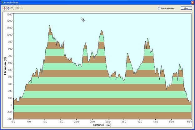
The Vertical Profile
The vertical profile is shown above ¢ the mileage shown is a little shorter than that actually covered due to the way the GPS records track logs. Duns is a little after the 30 mile mark.
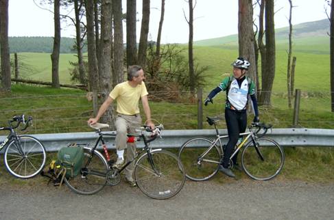
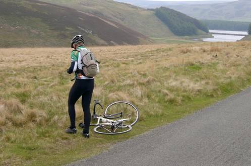
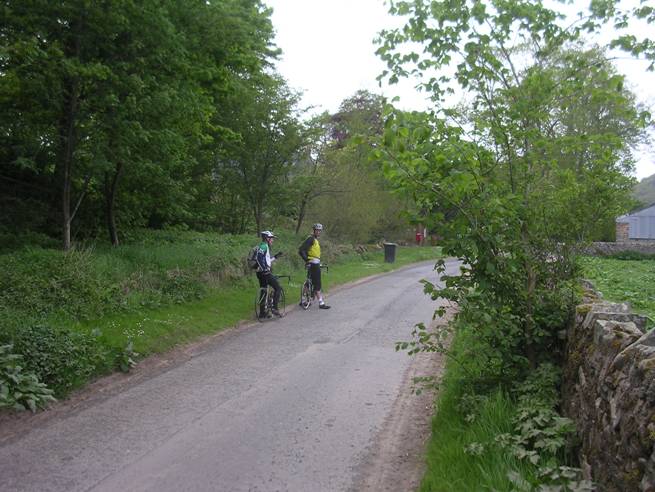
Pete and Sandy taking a rest after the first steep hill
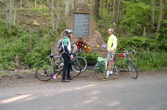
We emerged from the trees into moorland as the road continued up. We passed White Castle fort ¢ stopping briefly to read the information board ¢ and then tackled another very steep uphill. IÆd learned my lesson this time and paced myself up the hill better.
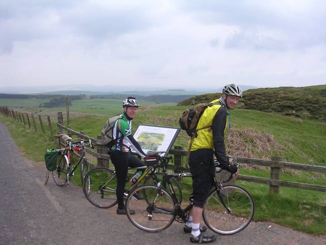
At White Castle Fort ¢ carbon, titanium and steel!
The road did some more ups and downs until descending to the Whiteadder Reservoir and joining the B6355. The cycle guide book promised a tea room between the end of the Reservoir and Cranshaws, but it was nowhere to be seen. All we got was another steep (but thankfully short) hill to climb at Hungry Snout. Now we were into lush, green farmland as we followed the river ¢ a complete contrast with the moors of just a few miles earlier.
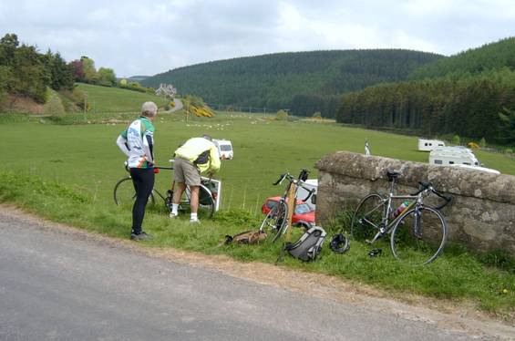
Sandy with the Whiteadder Reservoir up ahead
At this point we started seeing signs warning that the road would be closed the following day for The Jim Clark rally. We didnÆt think too much about it until we started to encounter a stream of cars going the other way.Up until this point traffic had been almost non-existent. We figured out that people were surveying the route ahead of the rally itself. (Jim Clark was an F1 driver who was killed in a racing accident in 1968. He lived near Duns and there is a centre dedicated to his memory in the town.) We stopped to admire the view at Ellemford Bridge, then turned right up another steep hill towards Longformacus (the origin of the name is obscure ¢ back in the dim and distant past it is recorded as Longfordmakehouse,) passing as much traffic in 5 minutes as that road probably sees in the rest of the year. We descended down to Longformacus and turned left towards Duns. Another long climb out the valley was followed by a long descent down into Duns where speeds of almost 40 mph were reached. The only concern going through our minds at this point was that whatever went down at this point, was going to need to go back up to get back to Dunbar!
Ellemford Bridge
In Duns we found the Black Bull Hotel ¢ fortunately weÆd arrived in time for lunch (about a quarter to two), and more importantly some liquid refreshment. A couple of pints were quickly downed during a leisurely sit in the beer garden in the sunshine ¢ although there was still quite a chilly breeze.
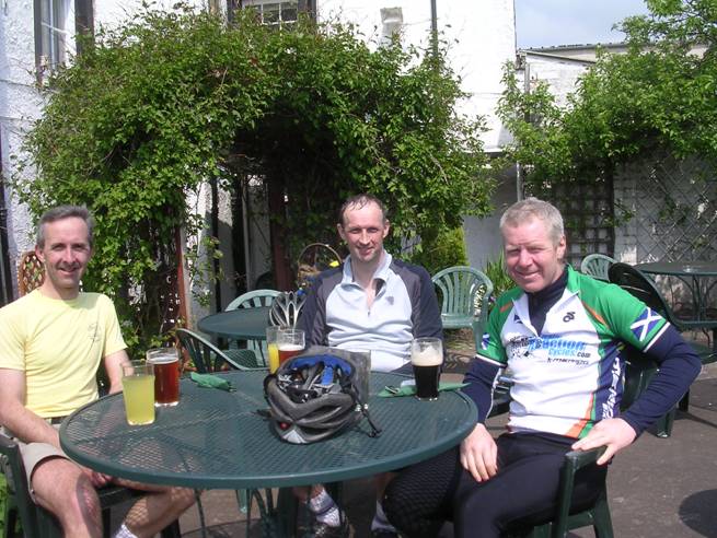
Lunch at The Black Bull
After lunch we headed back up the B6365 in the opposite direction. Again the road did a lot of descending as we continued along beside the Mill Burn, until a sharp right turn up another steep hill towards Abbey St Bathans where we crossed the Whiteadder Water again. The route along this part was well sheltered and the sun was out, making us feel distinctly warm.
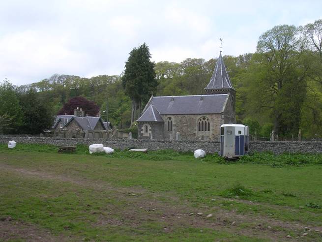
Abbey St Bathans
Pete stopped to take some photos ¢ and a 4x4 driver seemed to take umbrage that heÆd parked his bike temporarily in the middle of the road, shaking his head as he passed us.Ā Shortly after we had a choice of routes ¢ opting for the more adventurous looking one which also had some more of those double chevron uphills.
Waiting for Pete to Take Photos
The sun was completely out by this time and the wind reappeared as we climbed back up to the moors ¢ but this time it was coming more from behind us. We continued across the valleys, descending down to Oldhamstocks and Innerwick and then another steep descent into and climb out of The Brunt. As we descended down into Spott Pete reminded me that we had gone up this particular steep hill a couple of years earlier on the way to Berwick.I have to say I preferred going down it. From Spott we descended down into Dunbar into a strong onshore breeze and headed back to the station.
Between Innerwick and Spott
All in all an excellent ride that definitely earned its strenuous label on a superb day.
Average speed ¢ 12.4 mph
Max speed ¢ approx 38 mph