August 2008
After our effort around the Lammermuirs in May, I decided the next area to explore by bike would be around the borders – something a little flatter (or so the map seemed to suggest) with some historical interest thrown in for good measure. The planned route started and finished in Kelso, taking in Smailholm Tower, skirting St Boswells then down to Jedburgh and across to Yetholm and Flodden Field before returning to Kelso. I had even bought a new OS map of the Kelso area – more on that later – and programmed the route into the trusty GPS which now also had a new clip to keep it on the bike, courtesy of Garmin. This time I’d carefully picked out a route with none of those nasty chevron things – or so I thought.
We had picked out the date some time in advance – although the summer weather had been so bad that we were a bit dubious as to whether we would go or not. We watched the forecast for a week in advance – things looked promising – and indeed it turned out so with a beautiful, warm day – almost too warm at times.
Sandy did the driving honours again, picking me and Pete up and heading down to Kelso. By the time we were ready to set off it was 10.45 a.m – a bit of a late start, but we were in no particular hurry. Not much was made of the excuses beforehand this time – although Sandy had tired legs from mountain biking the night before, Pete was still handicapped by a solid steel bicycle and I’d already done 4 days cycling to and from work including riding home with Kenneth the Duracell bunny on Wednesday at a fair rate of knots.
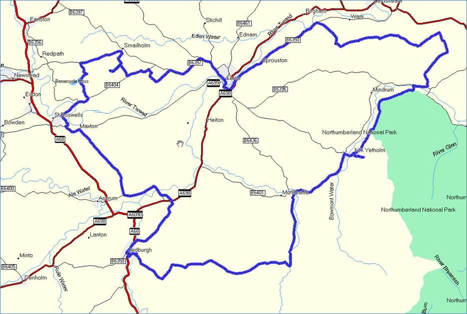
The Route
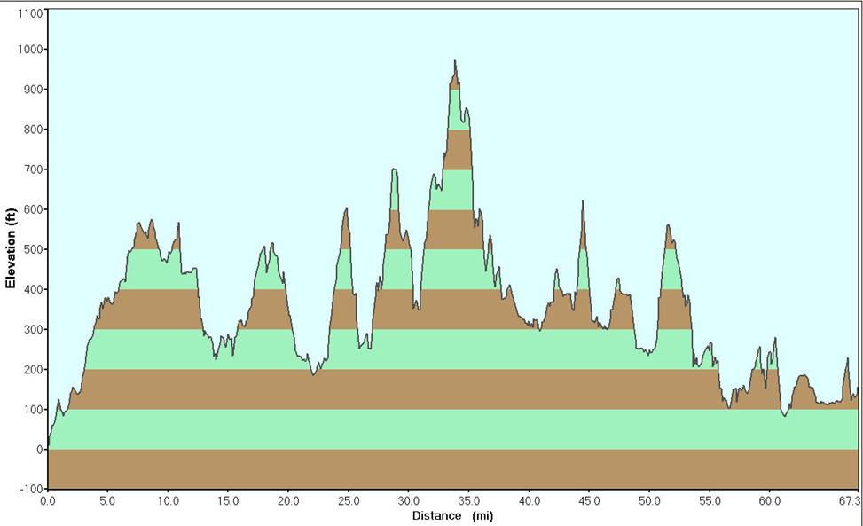
The Vertical Profile
The vertical profile is shown above – the mileage shown is a little shorter than that actually covered due to the way the GPS records track logs. Jedburgh is at about 27.5 miles – and as can be seen, there are some pretty serious ups and downs for the first few miles after that until the Kale Water is reached. I forgot to calibrate the barometer on the GPS, so the heights are relative and the start and finish heights are a little awry.
We made fairly steady progress out of Kelso and onto our first destination, Smailholm Tower – approximately 10 miles. It was originally built by the Pringles to protect themselves from the English Border Reivers, but really became well known as one of the places Sir Walter Scott visited in his childhood. It was sold to his Great Great Great Grandfather and then passed down the family. I didn’t realize it at the time, but Walter Scott’s epic poem, Marmion, links the two points of historical interest, using Smailholm as a setting and Marmion himself eventually being killed at Flodden.
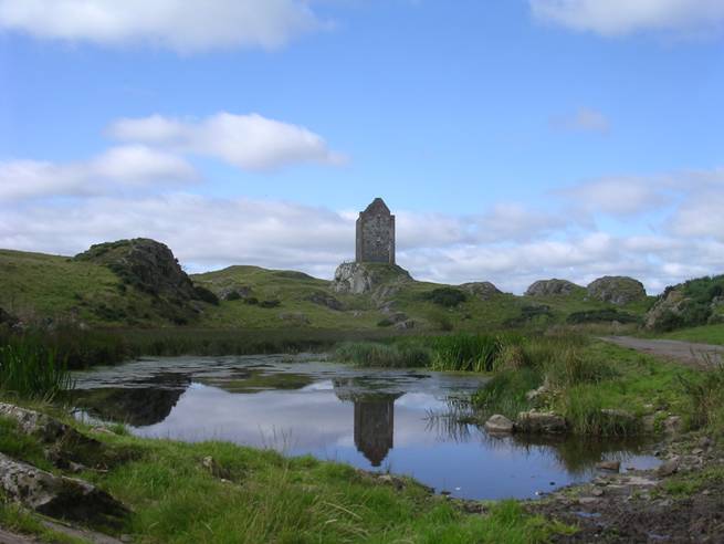
Smailholm with millpond and reflection
Pete stopped to take a few photos as we approached. We were somewhat amused to find a car park that was fenced off with lockable gates. I guess the idea is to keep the cows out of the car park, although they weren’t really in evidence today.
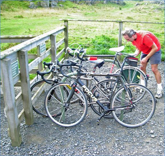
Arrival at Smailholm
We locked the bikes up with Pete’s trusty padlock, although the likelihood of anybody nicking them from here seemed remote. The guy at the desk in the ticket office offered to let us leave them up at the tower, but we didn’t feel like trekking back down to cart them up the hill.
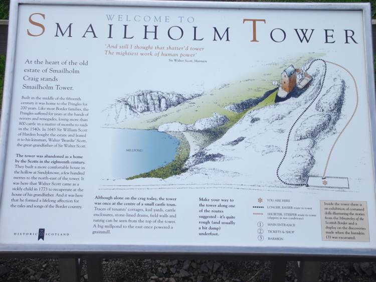
Information Board at Smailholm
Apparently Smailholm Tower is one of only eight tourist attractions in Scotland with a 5 star rating. I have no idea where the other seven are!
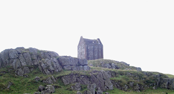
Smailholm Tower from the Car Park
The tower is a short walk up from the car park – it used to have additional buildings attached, but these no longer exist, although their outlines are still present. The barmkin (walled courtyard) wall was surprisingly thick – those reivers must have been determined types!

I Said The Walls Were Thick
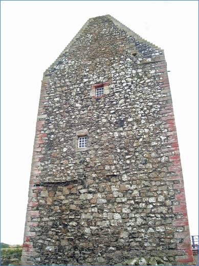
Smailholm Tower from the Barmkin – Just Waiting For A Young Maiden with Implausibly Long Hair!
We paid our 3 pounds 70p to gain access and explored the inside.It was an interesting place – an introductory exhibition outlining the history of the place and then an exploration of the 3 upper floors.
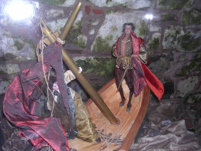
Devil Shipwreck - One of the Dolls in the Tower
There was also an exhibition of dolls from Scott’s Minstrelsy of the Borders – an example of one is shown above.
There was an audio tour available which we declined in the interests of time. At the top there was access to walkways (more like balconies really) on the north and south sides. We didn’t spend too long outside as there were hordes of flying ants which can just be made out in the picture below.
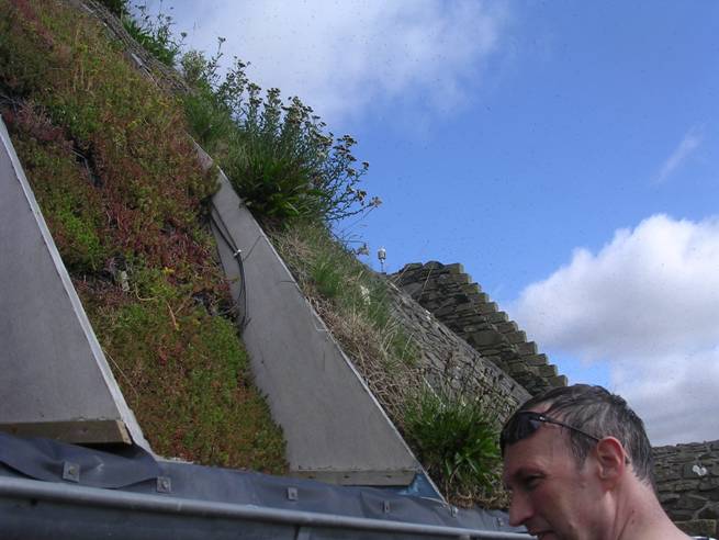
Smailholm roof with turf and clouds of flying ants
Judging by the number of buckets placed strategically on the top floor they have been suffering problems with leaks. We noticed turf and other plants on the roof, which I learned later is part of an experiment to try and provide waterproofing.
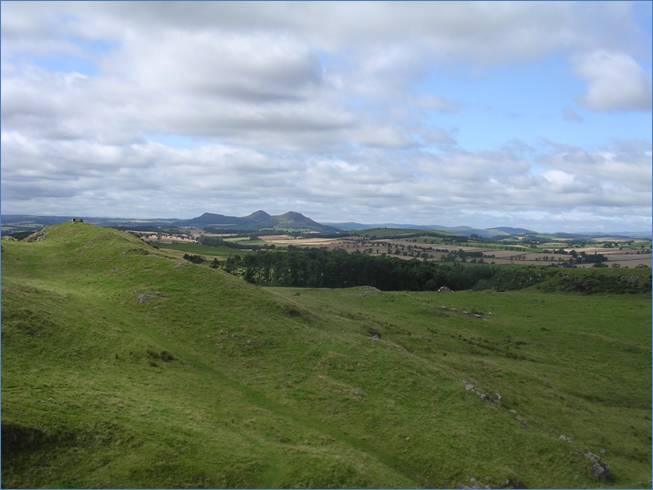
View to The Eildons (Tri Montium) from Smailholm
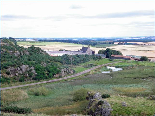
View to Sandyknowe Farm from Smailholm Tower
As we left Smailholm Tower along the rather stony track that can be seen in the picture above, there was a sudden sound of rushing air and Sandy’s front tyre went flat. There was no obvious hole in the tyre so he initially suspected a pinch flat – however on putting in a new tube the sudden deflation process repeated itself. This time closer inspection revealed a hole in the sidewall. An emergency tyre boot was applied, a patch applied to one of the tubes and this time the air remained contained. As we walked the last few yards down the track in order to avoid another repeat performance we noticed some curious looking fungi by the side of the path.
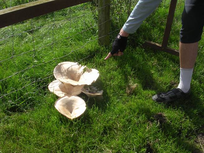
Giant Mushrooms
We continued on our way, turning left at St Boswell’s and crossing the Tweed, before continuing down towards Crailing and passing the Waterloo Monument. We decided that since time was getting on not to investigate it on this visit, continuing on a long uphill towards Jedburgh. We were slightly thwarted on the planned route down to Jedburgh – the intended road turned out to be a track – so we continued straight on down a very steep hill – which unfortunately had a T-junction at the bottom, so there wasn’t really an opportunity to fly down it at top speed. From there we joined the A68 into Jedburgh and went in search of a pub and lunch.We had covered about 27.5 miles – only another 40 or so to go! It was now after 2 p.m, although we’d only been cycling for 2 hours. We found a hopeful looking pub and quickly downed a couple of pints, but they didn’t serve food, so we went across the road to a café which seemed to be doing a roaring trade. There was some amusement over Sandy’s plans to leave room for pudding by just having a Panini – and then being offered chips to go with it. We all went for two courses – reckoning on having earned it. Having enjoyed our repast we prepared to set off again – only to discover that Sandy’s front tyre was flat again – the previously applied patch having given up. A new tube was inserted along with more air and we set off again.
We had a bit of trouble finding the right road out of Jedburgh – in amongst the housing estates – in fact Sandy and I managed to cycle right past it before Pete pointed out the obvious! At this point we went off the bottom of the OS map. After the rapid descent into Jedburgh we had been expecting a hill on the way out – we weren’t quite ready for the succession of steep ups that took us up to about 1000 feet. I guess that’s why they call it the Southern Uplands! The reason there weren’t any chevrons indicating steep hills on our route was obviously because we didn’t have the right map! When I got home I looked at the adjoining map – and sure enough those devilish little arrow things were hiding there all the time – only single ones it has to be said, but some of them were probably a bit marginal. I reckon I’d burned off all the sticky toffee pudding by the time we got to the final top! Looking at the map it appears that if we had stayed on our original course and not found the “correct” road that we could have gotten to Morebattle slightly more directly and up very much less steep hills – perhaps if I do this again I’ll do it that way next time. Of course, there wouldn’t be the same sense of satisfaction – and the scenery might not be quite so nice.
The descents were a bit tricky as well – there were quite a few sharp bends and a lot of grit on the road – so some care had to be taken to avoid ending up in the hedge!
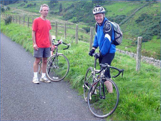
Taking a Break after the climb and descent and climb out of Jedburgh
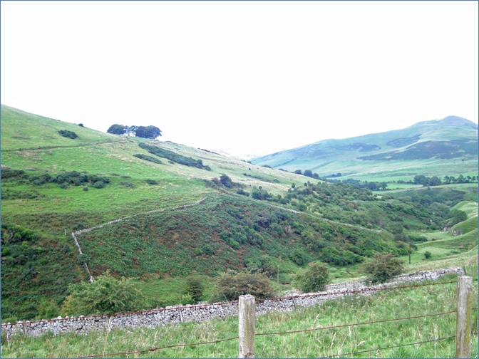
View up the Kale Water Towards Yetholm
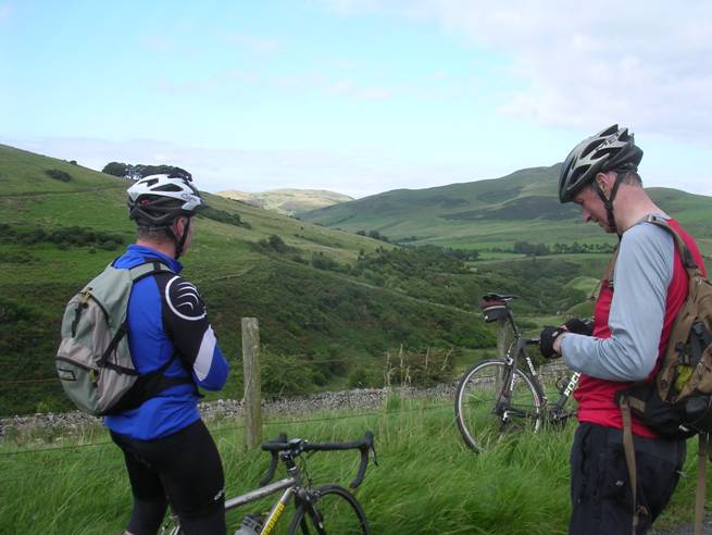
Same View with a Couple of People in the Way
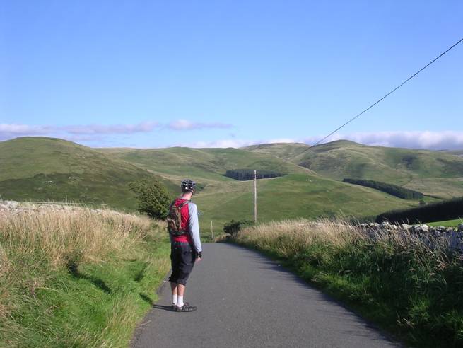
After the steep hills the road dropped down to the Kale Water and we turned left towards Morebattle and Yetholm. I had originally planned to take the detour into Morebattle, but somehow in my route planning on the GPS I managed to miss it out, so we ended up in Town Yetholm instead, having passed the turn off to Sourhope and Cocklawfoot along the way. From Town Yetholm we turned down towards Kirk Yetholm, the end of The Pennine Way – and for the sake of an interesting view decided to detour up towards Halterburn. There is a sign for the Peniel Revival Centre – which is a Christian run religious retreat. Apparently it used to be a hotel. We also passed the Gypsy Palace, which was once the residence of the royal family of the Faa gypsies. Having climbed to the top of the hill we wimped out of descending down to Halterburn given the steepness of the climb back up. Instead we admired the view across to the Scottish-English border.
On top of hill at Halterburn looking towards England
We met three people walking down the road who were just completing the Pennine Way – which brought back memories of 1976 when we walked it as a family in just over two and a half weeks. That was the driest summer in a very long time. This has surely been one of the wettest. (The three of them are sat at the table in the photo below.) We turned round and cycled back down to Kirk Yetholm for a quick pint at the Border Inn. It was very pleasant sitting out in the sunshine. There is still a picture of A.W Wainwright on the wall – but unfortunately the money to fund free pints for those who complete the Pennine Way dried up some time ago.
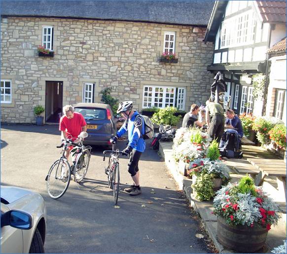
Getting Ready to Set Off After a Pint at the Border Inn
We then proceeded out of Yetholm and into England on our way to Flodden. Along the way the evening sun illuminated the fields where the harvest had been cut. All day we’d seen farmers taking advantage of the best day in a long time to cut their corn. People were still working well past 6 p.m on a Friday night.
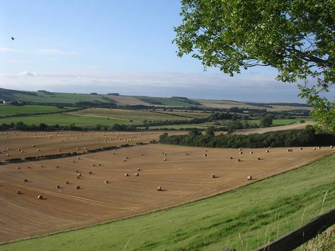
Looking Across Harvested Fields Near Yetholm
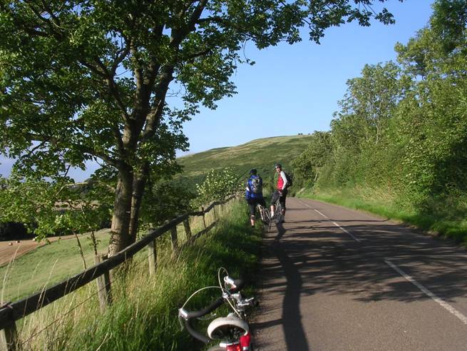
Short Pause for Photographs
The first few miles after Yetholm were nice and flat and we made rapid progress until we turned up towards Branxton where we hit another fairly steep up hill. This one was worth it for the downhill on the other side though – a straight road all the way into Branxton – although as Sandy put it a slight sphincter tightening moment as we crossed over a patch of gravel at well over 30 mph. One of those moments to make sure you keep it all pointed in a straight line and don’t touch anything, especially not the brakes. I got up to over 40 mph on that stretch and was still doing 30 having coasted up the slight incline into Branxton as I passed the 30 limit sign! At Branxton we turned left and headed towards Flodden Field for our second historical point of interest.
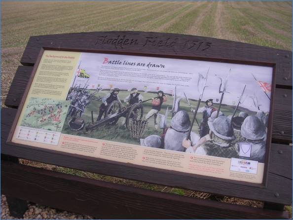
Information Board at Flodden Monument
Flodden of course is where James IV got well and truly duffed up by the English in 1513 in a somewhat ill-fated venture associated with the auld alliance. Some 10,000 Scots, including the king himself and 4,000 English are believed to have died on the afternoon of 9th September that year. James marshaled his troops on what is now Bruntsfield Links in Edinburgh before setting off for Flodden. The Bore Stone, where he supposedly placed the standard, can be found near the Dominion Cinema on Morningside Road – although it’s possible that this is just a boundary marker stone. The battle was actually fought at Branxton rather than Flodden – but the Flodden name has stuck.
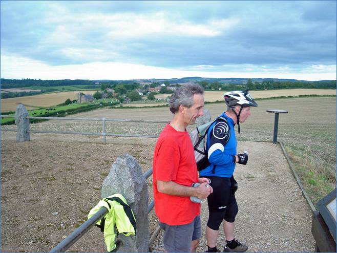
Sandy and Pete Learning Some History at Flodden
There is now a battlefield trail with information boards at various points along it explaining what is believed to have happened across the battlefield at different times. Apparently a number of the contemporary accounts are somewhat conflicting – and of course written mainly by the victors – so some interpretation and guesswork has been applied.
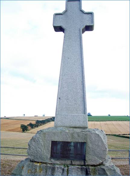
Flodden Monument
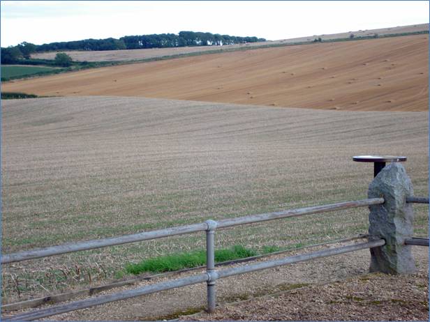
A Corner of Flodden Field
From Flodden we made our way the 12 or so miles back to Kelso. At one point we chased a hare along the road – it won easily! Again we were slightly thwarted in our planned route when one of the roads turned out to be a track – but this was no great problem – we simply rejoined the main road a bit earlier than planned. Along the way we crossed a bridge over what seemed almost like a disused canal – but later inspection of the map showed it to be a dismantled railway. We passed through Sprouston and then a final relatively short climb up into Kelso before descending down the hill and over the River Tweed again and into Kelso town centre. It was 7.45 p.m when we got back to the car – another half hour and we would have needed lights!
Another fine circuit – strenuous in parts but plenty of good scenery and some education along the way as well – and the weather was superb.
Total Distance – 70 miles (pretty much exactly.)
Total ascent – 7000 feet approx (which is 1700 more than we did in the Lammermuirs – but those seemed harder for the most part, except for the bit just after Jedburgh.)
Total Cycling Time – 5 hours 13 minutes – only half an hour more than it took us to do 58 miles in the Lammermuirs.
Total trip time – 9 hours (again, pretty much exactly).
Average speed – 13.3 mph
Max speed – approx 40.5 mph
Maximum rate of descent 478 feet per minute